
Central Activities Zone and Inner London
Knowing the total index value for every cell, we can estimate a median index for a borough in order to see a more general picture. The London Plan describes a division between Inner and Outer London, Inner London being a territory with higher population and density of jobs. The Central Activities Zone (CAZ), the central part of Inner London, is where the highest index values can be found. These territories have the "largest concentration of London's financial and globally-oriented business services. Almost a third of all London jobs are based there" (2.44).
The CAZ is also a cultural and retail centre of the city. The territories outside the CAZ can't compete with its density of cultural, retail and social infrastructure - so we couldn't expect the peak index values to be anywhere else. The other main feature of the CAZ, aside from that of the high infrastructure provision level, is that its population density is significantly lower than in the areas of Inner London surrounding it. This makes it a central business district with a high everyday commute level.
The CAZ is also a cultural and retail centre of the city. The territories outside the CAZ can't compete with its density of cultural, retail and social infrastructure - so we couldn't expect the peak index values to be anywhere else. The other main feature of the CAZ, aside from that of the high infrastructure provision level, is that its population density is significantly lower than in the areas of Inner London surrounding it. This makes it a central business district with a high everyday commute level.
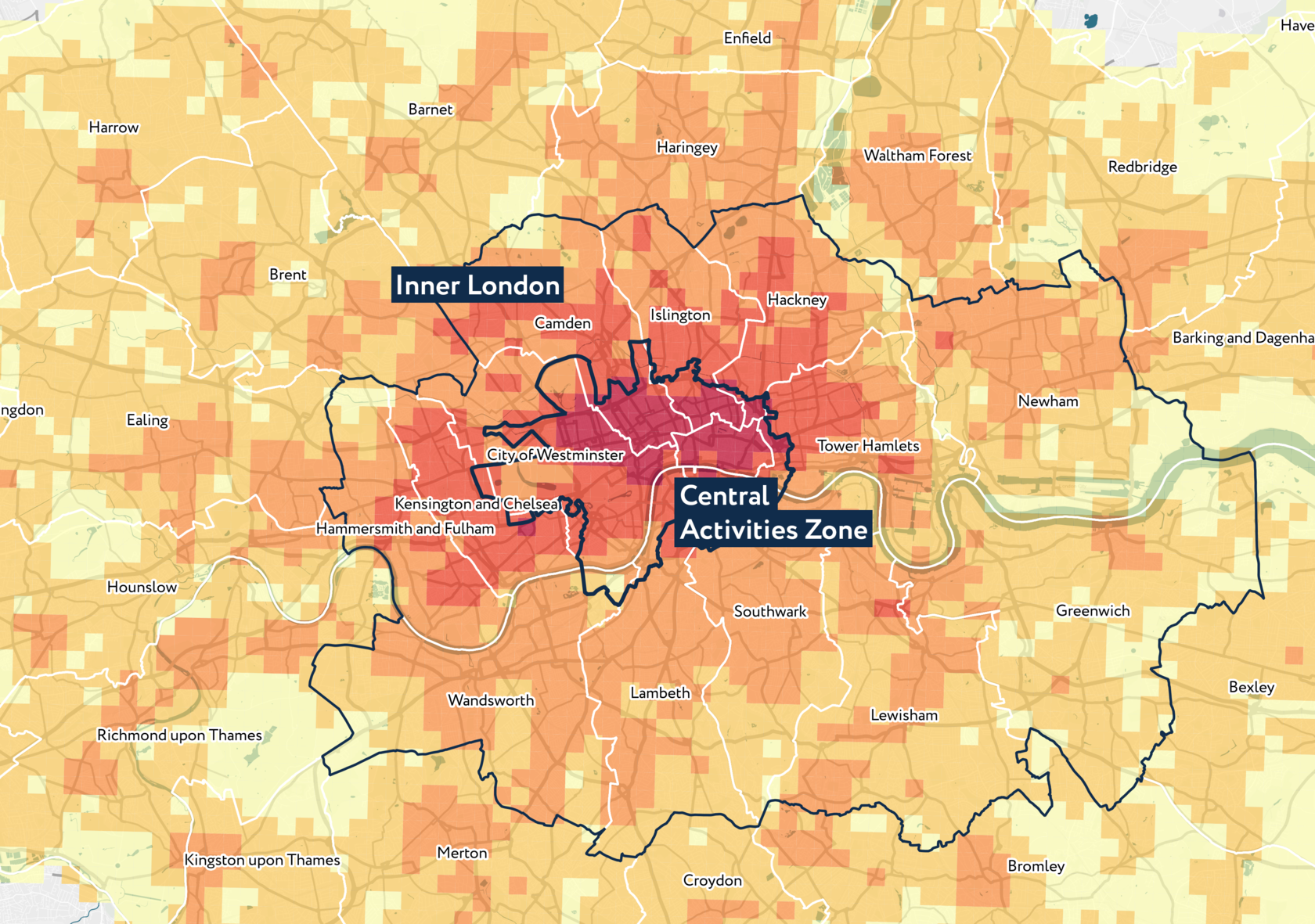
The Inner London territories surrounding the CAZ are diverse and contain "both what is probably the country's largest concentration of deprived communities and some of the most challenging environments in London, and places that have experienced remarkable growth and development." (2.38) Inner London has "high housing densities including many high-rise estates, relatively constrained access to open space, often outdated social infrastructure and low public sector educational attainment" (2.39).
The infrastructure provision here in general is higher than in Outer London; its median level is 47 out of a maximum of 90. Still, the differences between territories are significant - the highest index values can be found along main highways and streets and near underground stations. Our research can support tailored planning decisions for these territories identifying their specific challenges and benefits.
The infrastructure provision here in general is higher than in Outer London; its median level is 47 out of a maximum of 90. Still, the differences between territories are significant - the highest index values can be found along main highways and streets and near underground stations. Our research can support tailored planning decisions for these territories identifying their specific challenges and benefits.
Explore the map
IAT© can be integrated into existing urban planning systems in order to assess urban policy implementation and formulate place specific development programs. Explore the map with IAT© index layers corresponding to London Plan town centres, opportunity areas, brownfields and more.
Let's talk
Tell us how we can help you